
It’s the afternoon and you live in Honolulu. You have a relative’s birthday party that evening in Hauʻula so you need to head over there soon via your usual route along Pali Highway and Kamehameha Highway. Over the Koʻolau Range there are some really tall clouds and they’re not moving much. You think it might be raining hard, but is it enough to cause problems? This is the type of situation where you can look at the Honolulu Forecast Office’s (HFO) webpage to see if there are any short lead time hydrology products in effect. These products would advise you of possible flooding impacts along your route.
Unlike the long lead time products I covered last week, short lead time products are issued when heavy rainfall has already started, and flooding impacts are imminent or already occurring. These products are enclosed within the red box in the figure below.

Flow chart of National Weather Service (NWS) HFO products that can be issued during an idealized flash flood scenario. The items in the red box are short lead time products that provide limited or no advance notice of flooding.
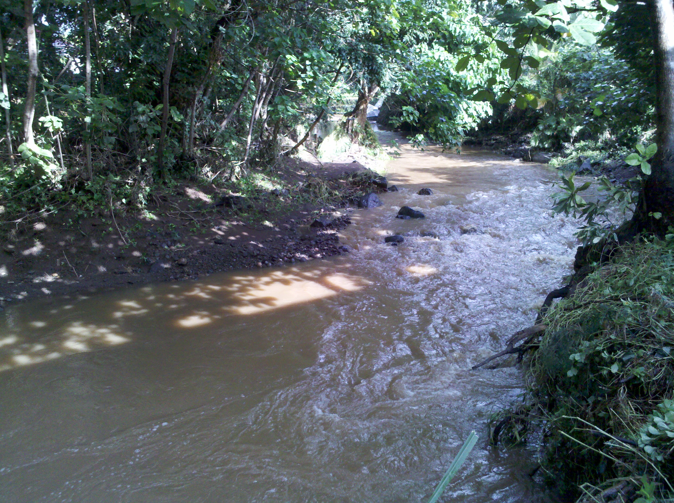
By far, the most frequently issued product is the Flood Advisory. This product is used when heavy rain occurs but is only expected to produce minor or nuisance flooding issues, such as ponding on roads. Streams and drainage ditches may run higher than normal, but are expected to remain within their banks unless conditions worsen. Areal coverage of a Flood Advisory includes the locations affected by heavy rainfall and areas downstream. Forecasters issue this product on occurrence and usually do not strive for lead time notification. On the HFO webpage, you will see a light green polygon over portions of the island included within the advisory. In general, the polygon will also include areas where rainfall may be expected to move into or develop over the next several hours. If rainfall is widespread enough, the Flood Advisory could include the entire island. The image below shows an example of a stream at a level appropriate for a Flood Advisory. The stream is brown and running higher than normal, but is within its banks.

Image of Mānoa Stream at an above normal flow level. The water is brown but is contained within the banks of the stream.
Here’s an example (below) of the Flood Advisory text. As with many NWS text products, portions of the text are mainly intended for automated systems to help with routing, dissemination, and graphics. The portion you’ll be most interested in is the headline in all caps and the statements bulleted by asterisks below it. The Additional Details section provides information on why the advisory was issued, and the locations included in the advisory. In this example, the advisory also mentions that a Flood Watch is in effect. This tells you that conditions could lead to flash flooding if the heavy rain persists or intensifies.

Archived Flood Advisory issued by HFO on January 30, 2025. The archive for HFO’s products is provided by Iowa State University’s Iowa Environmental Mesonet website.
If heavy rain is producing or is expected to produce flooding that is a threat to life and property, HFO forecasters will issue a Flash Flood Warning.This type of flooding includes situations where a stream overflows its banks, or overtops or washes out a bridge or road. It also includes the closure of public roads from fast flowing water or deep ponding that produces unsafe travel conditions. Runoff flowing into structures would also warrant a Flash Flood Warning. A dam or levee failure would also require a Flash Flood Warning due to the potential severity of the resultant flooding.
A warning is usually preceded by a Flood Advisory because satellites, radars, automated rain gages, and U.S. Geological Survey (USGS) stream gages will often provide the initial indications of a flooding event. If the heavy rainfall persists or intensifies, or if forecasters receive reports of significant flooding, a Flash Flood Warning would be issued and would supersede the advisory. Like the Flood Advisory, the coverage of a Flash Flood Warning will include areas of heavy rainfall that can produce in situ flooding and areas downstream from the rainfall. To help mitigate repeated warning notifications, the warning polygon will also include areas where heavy rainfall is expected to move into or develop within the next several hours.
Once issued, a Flash Flood Warning from HFO will have a three-hour duration by default. Updated information on the existing warning will be provided by a Flash Flood Statement. This information can include flooding impact reports, the latest locations of heavy rainfall, and rainfall totals. HFO will try to provide an update via Flash Flood Statement at least once during a three-hour warning cycle. If the flooding event is expected to go beyond the current three-hour warning period, it will be extended for another three hours. When heavy rainfall eases and floodwaters recede, the warning will be canceled or allowed to expire via the issuance of a Flash Flood Statement.
Flash flood events are not all the same. Some events may just close a couple of flood-prone roads, while others can produce widespread destruction and loss of life. That’s why in 2019, the NWS implemented Impact-Based Warnings (IBW) to its hydrology program. Through the use of “tags” within the text, IBW allows forecasters to issue different levels of warnings depending on the expected or reported level of impacts. Prior to IBW implementation, there was only a single level of warning that was disseminated the same way regardless of event severity.
The lowest tier of Flash Flood Warning is the “base” or “no tag” level. This is the most common type of Flash Flood Warning. It covers events where the warning is based on data from radars, rain gages, and/or stream gages, or impacts such as isolated road closures, or deep ponding that could flood the lowest level of a structure. This level of event will NOT activate the Wireless Emergency Alert (WEA) system on mobile devices, but it will activate Emergency Alert System (EAS) tones for radio and TV, and NOAA Weather Radio alerts. There is an exception to WEA activation for “base” level warnings in Hawaiʻi and it is for Flash Flood Warnings that cover the Hanalei area of Kauaʻi. The reason is that the closure of Kūhiō Highway along the Hanalei River can cut off the only exit route for all residents and tourists west of the Hanalei Bridge. Enabling WEA, even though the Hanalei River closure is the sole flooding impact, provides broader notification with hopefully enough time to leave the area.
An example of a “base/no tag” level of Flash Flood Warning occurred on May 10, 2024 in Hilo. The radar loop below shows very intense rainfall in red moving right over downtown Hilo. Although the area of intense rainfall was moving, rain gage observations and radar rainfall estimates indicated rates of 3 to 4+ inches per hour. In addition to being an urbanized area, downtown Hilo is near sea level with poor drainage, and the businesses can be flooded easily by intense rainfall.

Loop of composite reflectivity data from the May 10, 2024 (HST) Hilo flash flood event. The frames are screen captures from the NOAA National Severe Storms Lab’s Multi-Radar/Multi-Sensor (MRMS) system website. The images were cropped for visual clarity, and I added the annotation in red.
The image below shows the Flash Flood Warning issued for the event. The key information is found in the statements bulleted by asterisks. Note that the warning replaced a Flood Advisory that covered the initial part of the event.

Same as above text example, except for the Flash Flood Warning from the May 10, 2024 (HST) flash flood event in Hilo.
A Flash Flood Statement (below) was issued just 23 minutes later to provide updated information on the earlier warning. Hawaiʻi County Civil Defense reported that Waiānuenue Ave. and Kamehameha Ave., both significant roads in Hilo, were closed. Businesses in the Bayfront area also reported flooding later in the afternoon.

Same as above, except for the Flash Flood Statement from the May 10, 2024 (HST) Hilo event.
Flash flood events severe enough to need urgent action to protect lives and property would be issued with a “considerable” tag. Impacts from this level of event include (but are not limited to) multiple significant road closures or situations requiring evacuations and/or rescues from homes and vehicles. It could also include cases where a dam partially fails. Flash Flood Warnings issued with a “considerable” tag will activate WEA notifications on mobile devices within the warning polygon, along with EAS tones and NOAA Weather Radio alerts.
The kona low event in December 2021 produced widespread flash flooding with significant impacts to Honolulu and other areas of east Oʻahu. The radar loop below shows rainfall affecting the entire island, but the main band of activity was nearly stationary producing a “fire hose” of rain over east Oʻahu.

Loop of MRMS screen captures similar to previous loop, but for December 6, 2021 (HST). The mustard yellow/orange/red colors show the areas with the most intense rainfall. The red circle at the start of the loop shows the area with the most flood impacts.
The Flash Flood Statement shown below was issued to upgrade an existing “base/no tag” level warning to a “considerable” level warning. The reason, as indicated in the text, was not only due to the radar presentation of the event, but also because of significant increases in stream levels in Honolulu and on the windward side of the island. As seen in the Hilo example above, urban flooding can rapidly produce numerous flood impacts. Since this warning covered the entire island of Oʻahu, all mobile devices should have received a WEA activation. While it was not raining hard everywhere on the island, the alert lets people know that there is significant flooding over east Oʻahu. The subsequent warning, also shown below, served as a three-hour extension to the earlier warning due to the ongoing flood impacts, and provides information on actual flood impacts including vehicle rescues and evacuations from flooded homes.

Image of the Flash Flood Statement issued on December 6, 2021 to upgrade a Flash Flood Warning from “base/no tag” level to “considerable” level.

Same as above, but for the Flash Flood Warning issued to extend the earlier warning due to ongoing flooding impacts.
The final IBW tier for flash floods is the “catastrophic” level. These are also designated as a Flash Flood Emergency within the warning product. Events using this tag are rare, and should be reserved for situations where flooding results in or is expected to produce widespread damage and destruction, multiple swift water rescues, and widespread life-threatening conditions. Total dam failures would also be a cause for the “catastrophic” tag. Dissemination of “catastrophic” tagged warnings is the same as “considerable” tagged warnings.
An example of a “catastrophic” level warning event occurred on March 9, 2021 on Oʻahu. Intense rainfall over the windward slopes of the Koʻolau Range prompted a Flash Flood Warning that eventually became a “considerable” level event. Intense rainfall shifted to the northwest and subsequently poured into the headwaters of the ʻŌpaeʻula Stream, sending a large floodwave downstream towards Haleʻiwa town. The hydrograph below plots water level height from the USGS’ ʻŌpaeʻula Stream gage in March 2021. The water level increased from 4.1 feet at 1:05 PM HST to 15.9 feet at 3:10 PM HST, and more significantly, an increase of nearly 9 feet in 40 minutes. The increase in water level to 15.9 feet broke the record for height and flow at the gage by a significant margin.

USGS hydrograph from ʻŌpaeʻula Stream spanning the March 9, 2021 flash flood event.
Historically, severe flooding in ʻŌpaeʻula Stream has also caused loss of life in Haleʻiwa. With this in mind, the existing Flash Flood Warning (at “considerable” level) was upgraded with a Flash Flood Statement to a “catastrophic” tag/Flash Flood Emergency event. HFO quickly consulted with the Department of Emergency Management, which prompted an evacuation of Haleʻiwa prior to the impact of the floodwave. Fortunately, there was no loss of life or significant flood-related injuries. An image of the Flash Flood Emergency text is shown below.

Image of the Flash Flood Statement issued on March 9, 2021 to upgrade a Flash Flood Warning from a “considerable” level to a “catastrophic”/Flash Flood Emergency level.
Had enough? This is a long post, but I think it’s an important topic. Some of you may be thinking that this is so complicated! I don’t disagree. It can sometimes be challenging even for NWS staff to get all of this done right. The whole process tries to strike a balance between keeping things simple, but provide enough information and details for key partners and other consumers of the information to take appropriate action. Hopefully my explanations helped increase understanding of these products so that you have a better idea of what’s going on the next time we have a flash flood event in Hawaiʻi.